Bryce Canyon National Park
Adam Huff – April 13, 2023
All these factors combined to form Bryce’s remarkable features very quickly in the early post-flood years.
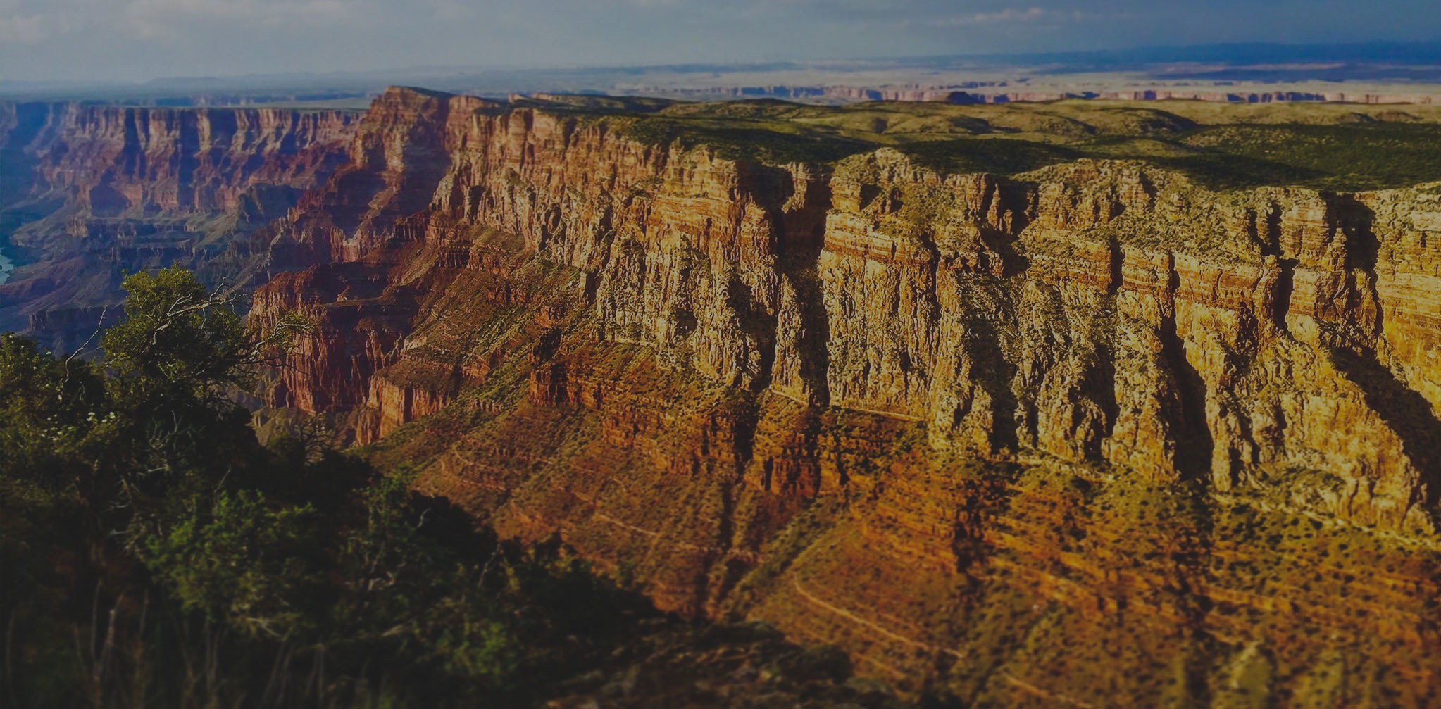
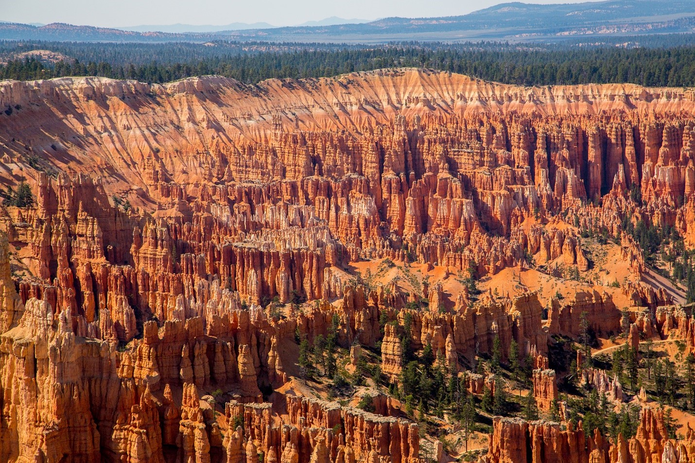
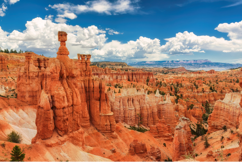
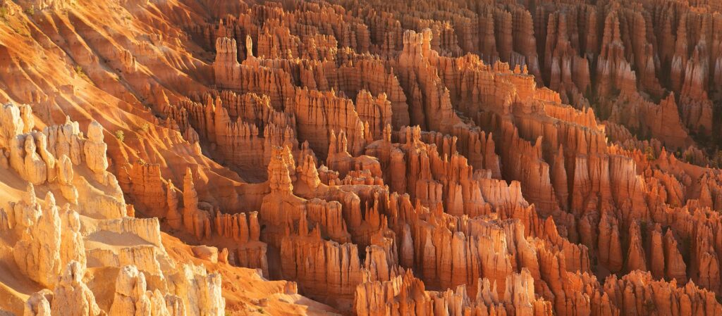
One hundred miles north of Grand Canyon lies a typical southern Utah plateau. Peculiarly named the Paunsaugunt, this relatively narrow strip of land juts out above the valley below. Exposed on its sides are beautiful pink cliffs of rock known as the Claron Formation, which have been carved into the world’s largest collection of hoodoos. Numbering in the thousands, these strangely shaped vertical columns of rock extend for miles across the landscape.
WHEN DID THESE FEATURES FORM, AND HOW DO
THEY FIT INTO THE NARRATIVE OF NOAH’S FLOOD?
Retreating floodwaters left behind a new world of deposited sediments and eroded features, but the landscape transformation did not end when Noah stepped off the ark. Across this region, the land was being pushed up in the years following. As plateaus and valleys took shape, natural dams began to hold back water, forming large lakes that later disappeared when the dams failed. Rapid evacuation of a body of water leads to a process called sapping, where water inside the rocks escapes out at the newly exposed bases, scalloping the cliff lines into rounded amphitheaters.
Relatively soft layers like the Claron are now ripe for hoodoo formation. The Claron consists of alternating beds of hard sandstones and limestones layered between softer mudstones. The varying hardness levels of these beds is the secret to hoodoo formation. The top of a hoodoo will be a tougher, erosion-resistant material. Around and below the cap, softer mudstones crumble and erode much more quickly, leaving behind a series of whimsically-shaped columns.
There is more to erosion than simply the removal of material by moving water or wind. Falling rain is often acidic in nature. Those acids can eat away at sedimentary rocks. In addition, as surface water seeps into cracks it can sheer off sections of rock as it freezes and expands. Bryce Canyon sits at an elevation of 8,000 to 9,000 feet above sea level, where the daily freeze-thaw cycle takes place as many as 200 times per year. Rockfalls are especially prevalent at the end of a wet winter season.
All these factors combined to form Bryce’s remarkable features very quickly in the early post-flood years. They continue to shape the area today, forming and eventually collapsing hoodoos, but at a much slower pace than what has taken place in the past. Over millions of years, the entire plateau would have long eroded away, but Bryce Canyon stands today as a testament to a young earth and a global, cataclysmic flood only thousands of years ago. God’s Word is true, and the evidence in His world supports it!
To learn more about this spectacular place, read Hoodoos of Bryce Canyon by our friend Dr. Andrew Snelling of Answers in Genesis.
Located just off Utah Highway 12 between the towns of Panguitch and Escalante, you can visit Bryce Canyon National Park any time of the year. For a hands-on experience with a professional and knowledgeable guide, consider a Grand Staircase Adventure trip with Canyon Ministries. Bryce is one of many stops on this six-day backpacking excursion into the Grand Staircase region.
Rene J Clavareza
Very blessed tours‼️🙏